In an earlier lab, python was utilized to create a map showing land value in the lower Chippewa River valley. In this lab, model builder methods were explored. For this lab we wanted to analyze the soil suitability using soil types, land use, and slope feature classes.
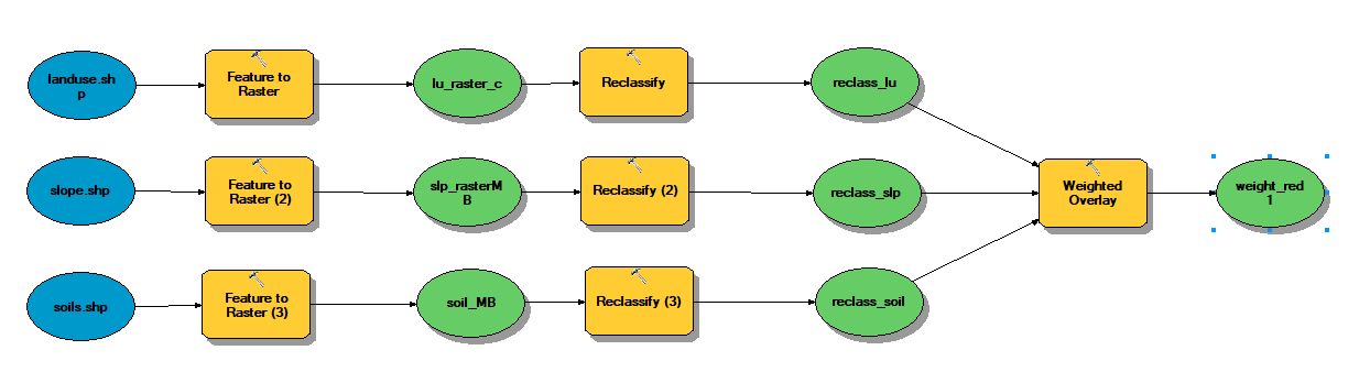
The model and processes for this lab can be seen above. As you can see the initial shapefiles were converted to raster and then reclassified using a specific code in their attribute tables. These reclassified rasters were given a specific weight. Soils was given the most weight at 50% and slope the least at 20%. Land use was given a weight of 30% to make up 100. The results of this model can be seen below.
This model builder technique will be used in conjecture with my semester research project. A preliminary model for that can be seen below. More information on this model will be given in my final blog post.


No comments:
Post a Comment